ShopDreamUp AI ArtDreamUp
Deviation Actions


Description
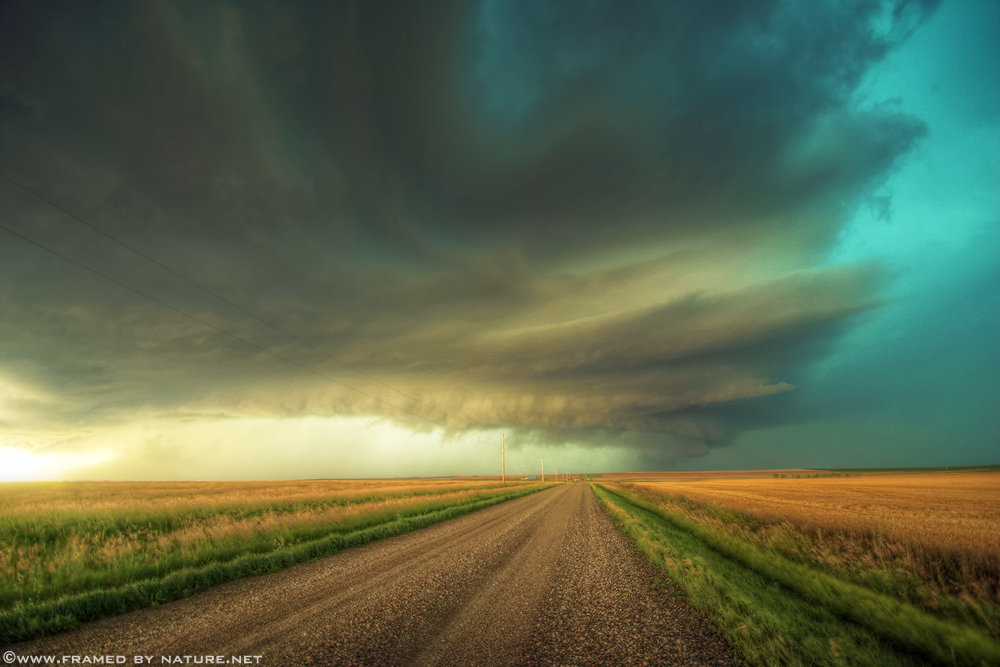
Witness the power of nature at Framed By Nature .NET
As this storm continued to track east-southeast over I-90, it became more organized both visually and on radar. At this point, it began to take on a "stacked plates" type of structure
Please tell me what you think!
Previous shots of this storm:


Image size
1000x667px 356.46 KB
Model
Canon EOS DIGITAL REBEL XSi
Shutter Speed
1/13 second
Aperture
F/3.5
Focal Length
10 mm
ISO Speed
100
Date Taken
Jul 23, 2010, 6:32:41 PM
© 2012 - 2024 FramedByNature
Comments20
Join the community to add your comment. Already a deviant? Log In
100% FAV8 